File:SCstatesanmap.png
From Asylum Projects
Revision as of 08:19, 18 August 2021 by Squad546 (talk | contribs) (Map of facility, 1938 Category:Floor Plans and Maps)

Size of this preview: 726 × 600 pixels. Other resolutions: 291 × 240 pixels | 1,428 × 1,180 pixels.
Original file (1,428 × 1,180 pixels, file size: 524 KB, MIME type: image/png)
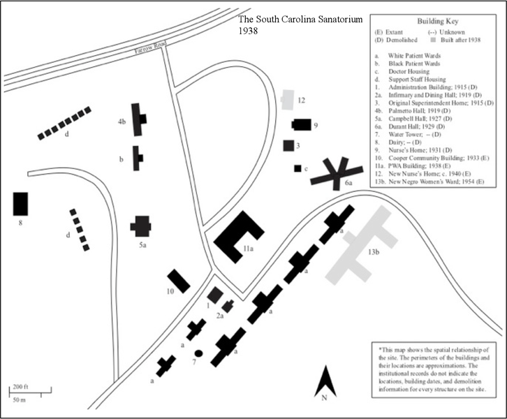
Map of facility, 1938
File history
Click on a date/time to view the file as it appeared at that time.
| Date/Time | Thumbnail | Dimensions | User | Comment | |
|---|---|---|---|---|---|
| current | 08:19, 18 August 2021 | | 1,428 × 1,180 (524 KB) | Squad546 (talk | contribs) | Map of facility, 1938 Category:Floor Plans and Maps |
- You cannot overwrite this file.
File usage
The following page links to this file: