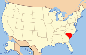
Difference between revisions of "South Carolina"
From Asylum Projects
m |
m |
||
| Line 17: | Line 17: | ||
| Length_mile = 260 | | Length_mile = 260 | ||
| Length_km = 420 | | Length_km = 420 | ||
| − | | total_state_population = 4, | + | | total_state_population = 4,723,723 (2012 est) |
| total_mh_inpatient_pop = | | total_mh_inpatient_pop = | ||
| year_past_peak_pop = | | year_past_peak_pop = | ||
| Line 37: | Line 37: | ||
* [[South Carolina State Hospital]] | * [[South Carolina State Hospital]] | ||
* [[Palmetto State Hospital]] | * [[Palmetto State Hospital]] | ||
| − | * William S. Hall Psychiatric Institute | + | * [[William S. Hall Psychiatric Institute]] |
==State Schools== | ==State Schools== | ||
* [[Pineland State Training School and Hospital]] | * [[Pineland State Training School and Hospital]] | ||
* [[Whitten Village]] | * [[Whitten Village]] | ||
| + | |||
| + | ==Sanitariums== | ||
| + | *[[Greenville Sanitarium]] | ||
| + | *[[South Carolina State Sanatorium]] | ||
| + | *[[Waverly Sanitarium]] | ||
[[Category:United States of America]] | [[Category:United States of America]] | ||


