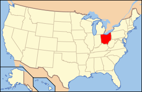
Difference between revisions of "Ohio"
From Asylum Projects
m (→County Institutions) |
m (→County Institutions) |
||
| Line 173: | Line 173: | ||
* [[Madison County Poor Farm]] | * [[Madison County Poor Farm]] | ||
* [[Mahoning County Infirmary]] | * [[Mahoning County Infirmary]] | ||
| − | * [[Marion County | + | * [[Marion County Poorhouse]] |
* [[Medina County Home]] | * [[Medina County Home]] | ||
* [[Meigs County Poorhouse]] | * [[Meigs County Poorhouse]] | ||
Revision as of 15:13, 7 July 2020
Contents
State Hospitals
- Appalachian Behavioral Healthcare Hospital
- Apple Creek State Hospital
- Athens State Hospital
- Broadview Developmental Center
- Cleveland State Hospital
- Cleveland Receiving Hospital
- Columbus State Hospital
- Dayton State Hospital
- Fairhill Psychiatric Hospital
- Hawthornden State Hospital
- Heartland Behavioral Healthcare Hospital
- Lima State Hospital
- Longview State Hospital
- Massillon State Hospital
- Mount Vernon Developmental Center
- Northcoast Behavioral Healthcare
- Northwest Ohio Psychiatric Hospital
- Ohio Hospital for Epileptics
- Orient Institute
- Summit Behavioral Healthcare Hospital
- Tiffin State Hospital
- Toledo State Hospital
- Twin Valley Behavioral Healthcare Hospital
- Woodside Receiving Hospital
State Schools
- Cambridge Developmental Center
- Columbus Feeble Minded Institute
- Gallipolis Epileptic Hospital
- Montgomery Developmental Center
- Northwest Ohio Developmental Center
- Southwest Ohio Developmental Center
- Springview Developmental Center
- Warrensville Developmental Center
- Youngstown Developmental Center
Federal Government Institutions
Reform Schools
Private Institutions
- Cincinnati Sanitarium
- Cuyahoga Falls Sanitarium
- Fair Oaks Villa
- Fallsview Psychiatric Hospital
- Glen Airy Home School
- Grandview Sanitarium
- Mc Millan Sanitarium
- Orchard Springs Sanitarium
- Oxford Retreat
- Rest Cottage
- Rest Cure Sanitarium
- Rodebaugh Sanatorium
- St. Francis Hospital
- Sawyer Sanatorium
- Scarlet Oaks Sanitarium
- Sunset View Sanitarium
- Toledo Sanitarium
- Windsor Hospital
- Woodruff Hospital
Sanitariums
- Clark County Tuberculosis Sanitarium
- Cleveland City Hospital Tuberculosis Sanitarium
- Cunningham Sanitarium
- Edwin Shaw Hospital
- Franklin County Sanatorium
- Hamilton County Tuberculosis Sanatorium
- Lima State Tuberculosis Hospital
- Lucas County Tuberculosis Hospital
- Molly Stark Sanitarium
- Mount Logan Sanatorium
- Ohio State Sanatorium
- Rocky Glen Sanatorium
- Springfield Lake Sanatorium
- Stillwater Sanitarium
- Sunny Acres Sanitarium
- William Roche Tuberculosis Sanatorium
County Institutions
- Adams County Farm
- Allen County Infirmary, Ohio
- Ashland County Infirmary
- Ashtabula County Poorhouse
- Athens County Infirmary
- Auglaize County Infirmary
- Belmont County Infirmary
- Brown County Infirmary
- Butler County Infirmary
- Carroll County Poor Farm
- Champaign County Poorhouse
- Clark County Infirmary
- Clermont County Infirmary
- Clinton County Home
- Columbiana County Poorhouse
- Cooley Farms
- Coshocton County Poorhouse
- Crawford County Infirmary
- Cuyahoga County Poorhouse
- Darke County Infirmary
- Defiance County Poorhouse
- Delaware County Poorhouse
- Erie County Infirmary
- Fairfield County Infirmary
- Fayette County Poorhouse
- Franklin County Infirmary
- Fulton County Poorhouse
- Gallia County Infirmary
- Geauga County Infirmary
- Greene County Infirmary
- Guernsey County Poorhouse
- Hamilton County Infirmary
- Hancock County Farm
- Hardin County Infirmary
- Harrison County Infirmary
- Henry County Infirmary
- Highland County Poor Farm
- Hocking County Infirmary
- Holmes County Infirmary
- Huron County Infirmary
- Jackson County Poor Farm
- Jefferson County Infirmary
- Knox County Poor Farm
- Lake County Poorhouse
- Lawrence County Poorhouse
- Licking County Infirmary
- Logan County Infirmary
- Lorain County Infirmary
- Lucas County Infirmary and Hospital
- Madison County Poor Farm
- Mahoning County Infirmary
- Marion County Poorhouse
- Medina County Home
- Meigs County Poorhouse
- Mercer County Poorhouse
- Miami County Infirmary
- Monroe County Infirmary
- Montgomery County Infirmary
- Morgan County Poorhouse
- Morrow County Infirmary
- Muskingum County Infirmary
- Noble County Infirmary
- Ottawa County Infirmary
- Paulding County Poor Farm
- Perry County Infirmary
- Pickaway County Infirmary
- Pike County Infirmary
- Portage County Infirmary
- Portsmouth Receiving Hospital
- Preble County Infirmary
- Putnam County Infirmary
- Richland County Infirmary
- Rollman Receiving Hospital
- Ross County Home
- Sandusky County Poorhouse
- Scioto County Infirmary
- Seneca County Infirmary
- Shelby County Infirmary
- Stark County Infirmary
- Summit County Home
- Trumbull County Poor Farm
- Tuscarawas County Infirmary
- Union County Infirmary
- Van Wert County Poorhouse
- Vinton County Poor Farm
- Warren County Infirmary
- Washington County Infirmary
- Wayne County Poor Farm
- Williams County Poor Farm
- Wood County Infirmary
- Wyandot County Poor Farm


