File:MIpontiacSHmapkey.jpg
From Asylum Projects
Jump to navigationJump to search
Size of this preview: 475 × 599 pixels. Other resolution: 2,119 × 2,673 pixels.
Original file (2,119 × 2,673 pixels, file size: 1.26 MB, MIME type: image/jpeg)
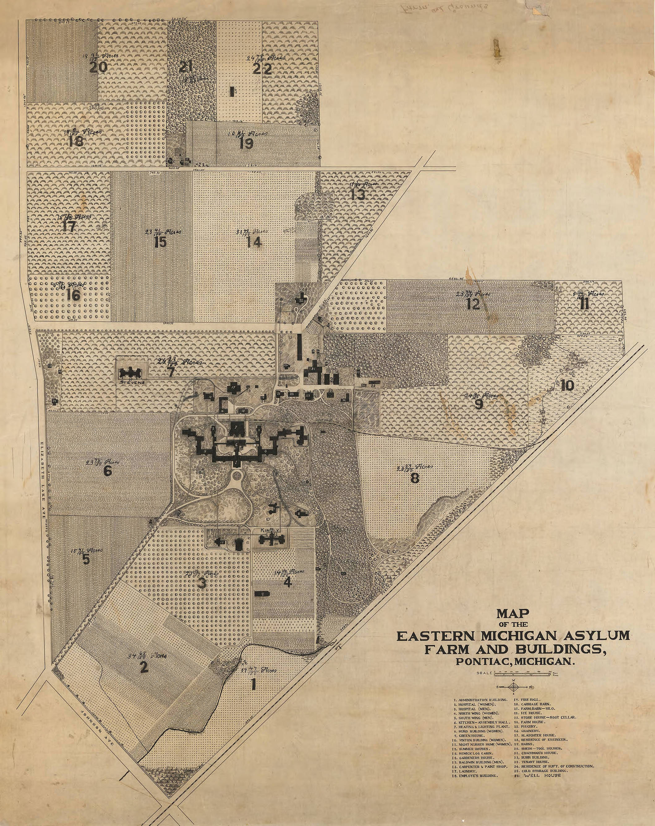
This maps shows the grounds and buildings of what later became Pontiac State Hospital. The map also shows the agricultural acreage with crops planted approximately in 1930.
File history
Click on a date/time to view the file as it appeared at that time.
| Date/Time | Thumbnail | Dimensions | User | Comment | |
|---|---|---|---|---|---|
| current | 05:04, 7 August 2016 | | 2,119 × 2,673 (1.26 MB) | Squad546 (talk | contribs) | This maps shows the grounds and buildings of what later became Pontiac State Hospital. The map also shows the agricultural acreage with crops planted approximately in 1930. Category:Floor Plans and Maps |
You cannot overwrite this file.
File usage
The following page uses this file: