File:Pough1922.jpg
From Asylum Projects
Size of this preview: 601 × 600 pixels. Other resolutions: 240 × 240 pixels | 1,024 × 1,022 pixels.
Original file (1,024 × 1,022 pixels, file size: 102 KB, MIME type: image/jpeg)
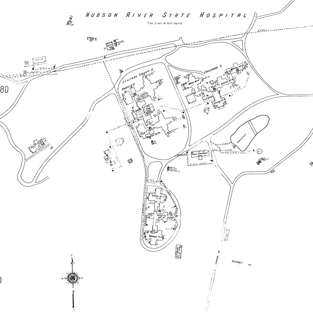
1922 Sanborn map of Central Group II, which were west of the Kirkbride. Includes Edgewood 4 & Inwood buildings. These have been demolished & all that remains is the reservoir, 2 staff residences and chapel.
File history
Click on a date/time to view the file as it appeared at that time.
| Date/Time | Thumbnail | Dimensions | User | Comment | |
|---|---|---|---|---|---|
| current | 02:26, 31 March 2010 | | 1,024 × 1,022 (102 KB) | Squad546 (talk | contribs) | 1922 Sanborn map of Central Group II, which were west of the Kirkbride. Includes Edgewood 4 & Inwood buildings. These have been demolished & all that remains is the reservoir, 2 staff residences and chapel. |
- You cannot overwrite this file.
File usage
The following page links to this file: